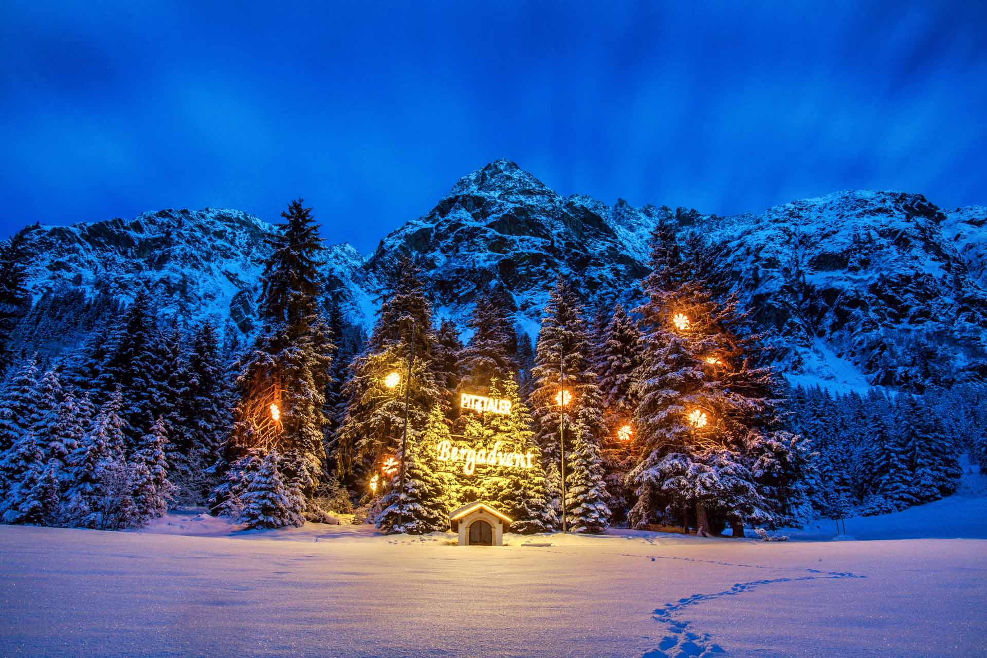
Wohltuend, unkompliziert, individuell und persönlich. Danke, dass Ihr Eure wertvolle Zeit bei uns verbringen möchtet. Ein Haus voller Tradition, Gastfreundschaft und Herzlichkeit. Eingebettet in die traumhaft schöne Bergwelt des Pitztals liegt unser familiär geführtes 4-Sterne-Hotel Sonnblick auf 1616 m Seehöhe in Plangeross, einem kleinen Bergdorf in der Gemeinde St. Leonhard.
Abseits des alltäglichen Trubels erlebst Du in unserem Hotel im Pitztal entspannte Stunden und viel Raum, damit Du Deinen ganz persönlichen Urlaubstraum verwirklichen kannst.
Wir freuen uns sehr, Euch kennenzulernen!
Eure Gastgeberfamilie Rainer
Alexandra & Willi und Michelle & Jonathan mit Milian
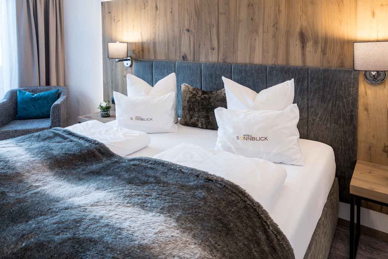
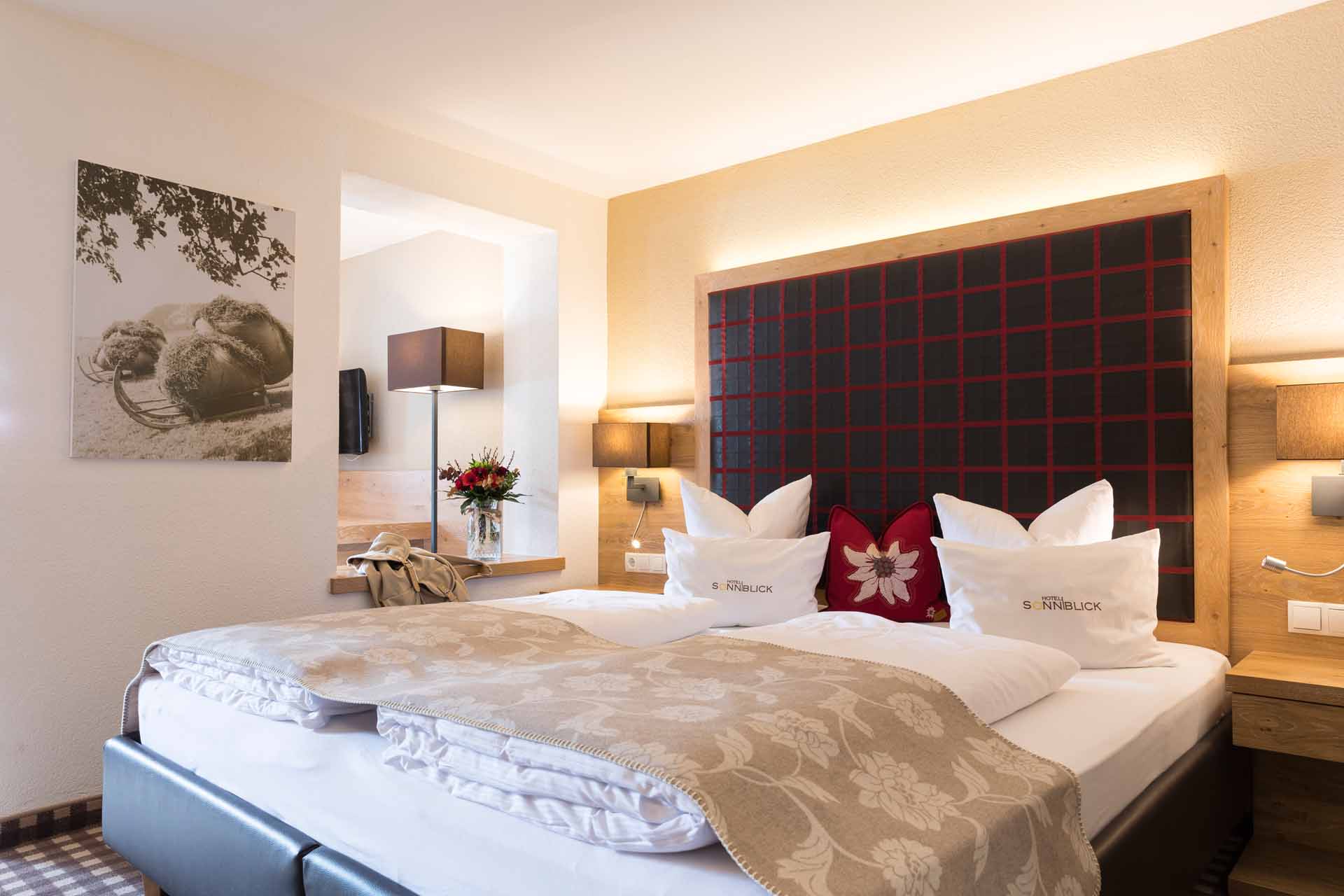
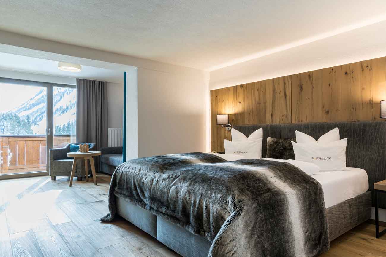
In unserem Hotel im Pitztal wohnst Du in gemütlichen und modernen Zimmern mit freiem Blick auf den wohl schönsten Talabschluss der Welt. Die faszinierende Bergwelt Tirols liegt Dir zu Füßen. Wir setzen auf gemütlichen alpenländischen Stil. Hier kannst Du entspannen und Deinen Urlaub im Hotel im Pitztal genießen!
Ursprung und Heimat - dafür stehen wir als Gastgeberfamilie. Tief verwurzelt im Pitztal verbinden wir traditionelle Werte mit Mut zur Veränderung. Als Gastgeber in der dritten Generation ist es unser Antrieb, stetig besser zu werden - ganz im Sinne unserer Gäste.
Bewertungen
Das sagen unsere Gäste
Christoph
Ein wirklich extrem schönes Hotel!
Weiterlesen
Ein wirklich extrem schönes Hotel mit sehr freundlicher Inhaberfamilie, schönem Wellnessbereich, sehr elegantem Ambiente, riesigem Frühstücksbereich und traumhaftem Blick Richtung Pitztaler Gletscher. Preis-Leistung sind wirklich sehr gut, auch das zum Hotel gehörende Restaurant Bergwerk gleich daneben ist einen Besuch wert. Falls wir nochmal ins Pitztal kommen definitiv wieder in dieses Hotel! Mehr als verdiente volle 5 Sterne!
Matthias
Sehr freundliches Hotel mit sehr gutem Essen
Weiterlesen
Sehr schönes, sauberes Hotel mit bester Lage für den Urlaub in den Bergen. Sehr freundliches Personal, bequeme Betten, sehr gutes und mit Liebe zubereitetes Essen. Wir hatten Halbpension und waren sehr begeistert von der Qualität und Auswahl der Speisen. Das Frühstücksbuffet lies keine Wünsche offen.
Barbara
Schöner erholsamer Urlaub
Weiterlesen
Ein schönes familiäres Hotel. Wir waren insgesamt 7 Tage dort und hatten HP. Der Service ist sehr freundlich und aufmerksam. Die Zimmer sind alle modern und gemütlich ausgestattet. Das Frühstücksbuffet lässt auch keine Wünsche offen. Der Skibus fährt morgens alle ca. 10 min Richtung Gletscherbahn. Das Hotel kann ich somit nur empfehlen.
Ruedi
Kann ich als Skiurlaub nur bestens weiterempfehlen
Weiterlesen
Sehr schönes Hotel, große schöne Zimmer, großes Bad, Dusche und WC, alles sehr sauber, sehr freundliches Personal, aufmerksame Chefin. Der 5-Gänger mehr als genug, feines Frühstück Buffet. Freundliches Servicepersonal. Mit Skibus in 5 Minuten an der Talstation. Alles in allem können wir nur weiterempfehlen.
Ulrike
Der Gast ist König
Weiterlesen
Das Hotel Sonnblick in Plangeroß ist ein familiengeführtes Haus (3. Generation und 4. in den Startlöchern!) mit modern-gemütlich eingerichteten, sehr sauberen Zimmern, erst kürzlich renoviert. Man ist innerhalb weniger Minuten an der Talstation der Skigebiete. Wir können das Hotel Sonnblick uneingeschränkt für einen Urlaubsaufenthalt empfehlen!
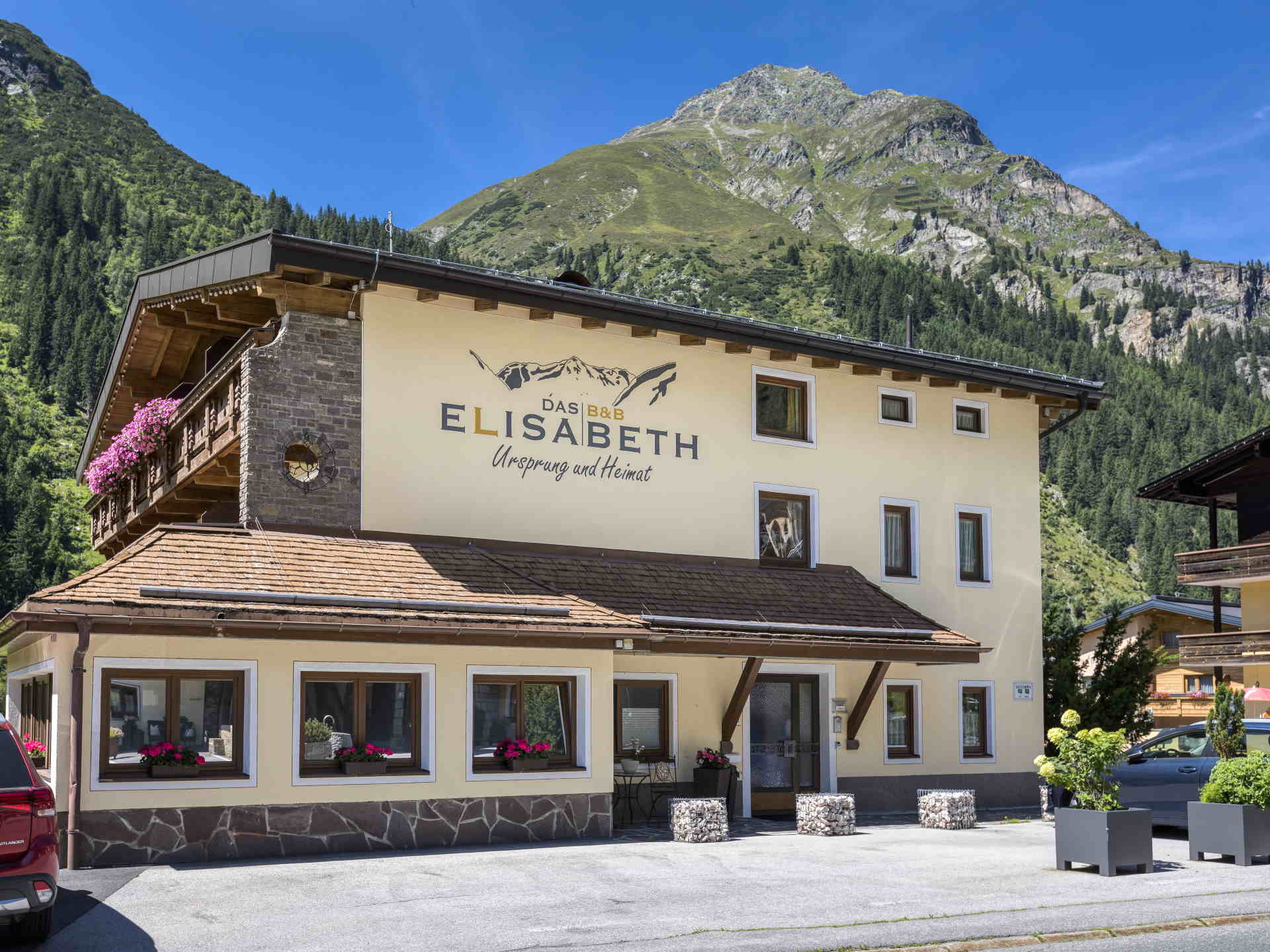
Das Haus Elisabeth in Plangeross bietet gemütliche Zimmer mit Frühstück in bester Lage. Nur wenige Kilometer vom Pitztaler Gletscher und Rifflsee entfernt, ist das Haus Elisabeth die optimale Unterkunft im Pitztal für Euren Aktivurlaub.
Der Pitztaler Bergsommer wartet auf Dich! Ob unvergessliche Gipfelerlebnisse, Bergwandern im Naturpark Kaunergrat oder kulinarischer Genuss - wir laden Dich ein, den Alltag zu vergessen und in die Freiheit der Berge einzutauchen.